

Why Volunteers Need a Dedicated App
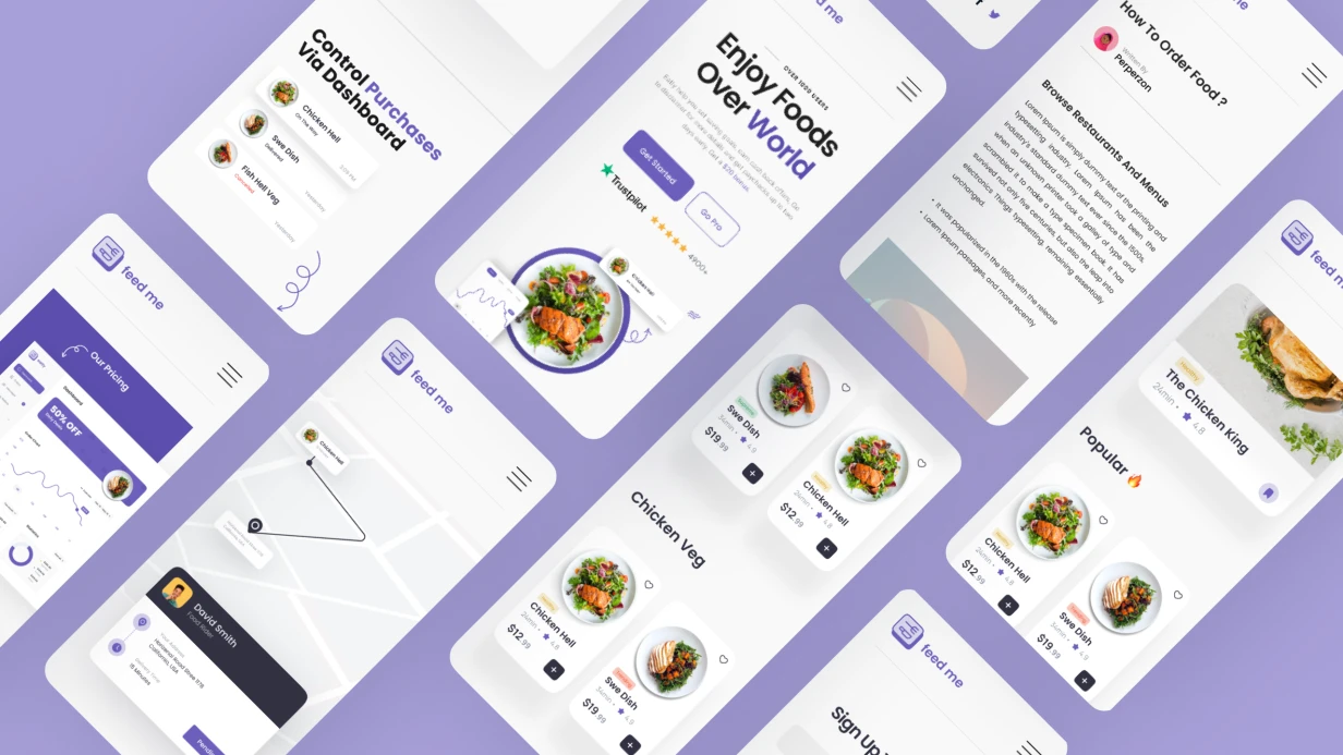
Organizations often try to manage volunteers through Google Forms and chats. This leads to data loss: who came, how many hours worked. Hundreds of notifications in a common chat — volunteers stop reading them. Manual tracking takes up to 10 hours a week for a coordinator. In one NGO project, the coordinator spent 12 hours a week reconciling Excel sheets — after app implementation, that time dropped to 30 minutes. We solve this by developing a volunteer app for mobile app development that includes a volunteer event map, QR code check-in and geolocation check-in, volunteer hour tracking, and automatic volunteer certificates. With push notifications volunteering, we improve communication. Volunteer onboarding is streamlined.
How to Organize Event Geolocation?
A map with event markers is the foundation. The volunteer event map uses MapKit (iOS) or Google Maps SDK (Android). With 50+ events, clustering is mandatory: MKAnnotationView with MKClusterAnnotation on iOS, ClusterManager from Maps Utils on Android. For finding nearby events — a server request with lat, lng, radius parameters. On the server — PostGIS ST_DWithin() or the Haversine formula. Filter by category, date, organization. Geofencing for notifications about new events in the radius: CLLocationManager.startMonitoring(for: CLCircularRegion) (iOS) or Geofencing API (Android). The iOS limit is 20 regions simultaneously. To scale, we dynamically update the set of regions when the user moves 500 meters.
To implement geofencing correctly, you must consider user permissions. According to the App Store Review Guidelines, apps must request location access only when in use and explain the purpose. We add an onboarding screen explaining why location is needed.
What Volunteer Hour Tracking Provides
Volunteer hour tracking records hours automatically or confirmed by the organizer. In the profile — history by month and category, annual total. For example, in 6 months a volunteer can accumulate 200 hours with weekly participation. We generate volunteer certificates as PDFs on the server (WeasyPrint or Puppeteer), download via URLSession.downloadTask. On iOS, we open via UIActivityViewController — save, print, or share. This volunteer hour tracking improves transparency and reduces coordinator workload by 50%.
Comparison of Check-In Methods
| Method | Speed | Reliability | Equipment Required |
|---|---|---|---|
| QR code check-in | <1 sec | High (98% success) | Smartphone camera, organizer's screen |
| Geolocation check-in | 3–5 sec | Medium (depends on GPS, 80% indoors) | GPS enabled |
| Manual mark | 10+ sec | High (99% accurate) | None |
QR code check-in is 2–3 times faster than geolocation check-in but requires contact. Geolocation check-in is convenient outdoors but may fail indoors. We combine both methods: outdoors — geolocation check-in, indoors — QR code check-in. This flexibility covers 95% of scenarios.
Which Technologies We Use for Different Platforms
For iOS volunteering apps, we use SwiftUI; for Android volunteering apps, Jetpack Compose. For cross-platform, Flutter or React Native with native maps.
| Component | iOS | Android | Cross-platform |
|---|---|---|---|
| UI | SwiftUI | Jetpack Compose | Flutter / React Native |
| Maps | MapKit | Google Maps SDK | flutter_map / react-native-maps |
| Camera (QR) | AVFoundation | CameraX | camera (pub.dev) / react-native-camera |
| Push | APNs | FCM | firebase_messaging / react-native-firebase |
| Storage | CoreData / CloudKit | Room | Hive / WatermelonDB |
For a single codebase, we choose Flutter or React Native with native maps. If native UI and animation performance matter — native iOS/Android.
How to Set Up Push Notifications Volunteering
Push notifications volunteering is the key communication channel. On iOS, we use APNs with priority critical for urgent events (event cancellation), on Android — FCM with notification channels. Device tokens are stored in the database, filtered by geography and interests when sending. Deep linking (Universal Links / App Links) leads directly to the event page. To set this up, we configure apple-app-site-association and assetlinks.json. This yields up to 70% conversions from notifications into the app. Following App Store Review Guidelines volunteering apps ensures approval.
Development Stages
- Analytics: study processes, design role model (volunteer, organizer), prototype screens.
- Architecture: configure geofencing, push (FCM/APNs), deep linking (Universal Links / App Links).
- Implementation: write code in SwiftUI or Jetpack Compose, integrate maps and camera.
- Testing: verify check-in on 10+ devices, load test push up to 10,000 concurrent.
- Deployment: publish to App Store and Google Play, following App Store Review Guidelines (Sections 4.2/5.1), Code Signing and provisioning profiles.
What's Included in the Result
- Source code with build documentation.
- Access to App Store Connect / Google Play Console.
- Integration with your backend (REST/GraphQL) or setup of Firebase / Supabase.
- CI/CD (GitHub Actions / Bitrise).
- Team training (2 webinars).
- 1 month technical support.
Why Choose Us?
Over 5 years developing mobile apps. We have launched 30+ projects for NGOs and social startups. Each app undergoes a security audit (ProGuard/R8, trace protection). We guarantee compliance with store policies. The average coordinator time savings after implementation is 10 hours per week, which translates to significant cost savings — for a typical nonprofit, this saves $12,000 annually. Get a consultation — we'll analyze your requirements, propose architecture, and provide a timeline in 2 days. Contact us today.
Example geofencing configuration for iOS
let region = CLCircularRegion(center: CLLocationCoordinate2D(latitude: 53.9, longitude: 27.56), radius: 100, identifier: "event1")
region.notifyOnEntry = true
region.notifyOnExit = false
locationManager.startMonitoring(for: region)
The 20-region limit — optimization through dynamic updates when the user changes city.