



Visitors don't linger over maps and plans: what to do
A visitor comes to a museum or exhibition for impressions, but the first thing they see is a static plan. On it, every exhibit, brand, and route looks the same — so the eye glides over the map for a couple of seconds, and the guest heads into the hall at random.
That's how both time and the most interesting highlights of the exhibition get lost — the very things the person came for. A carefully designed exhibition never gets to shine: key zones sit empty, visitors don't know where to go, and they leave without wanting to come back.
Organizers invest in content and design but gain neither audience retention, nor a live response, nor reach for partners. This is precisely where the event's value is lost — the very value the exhibition was created for.
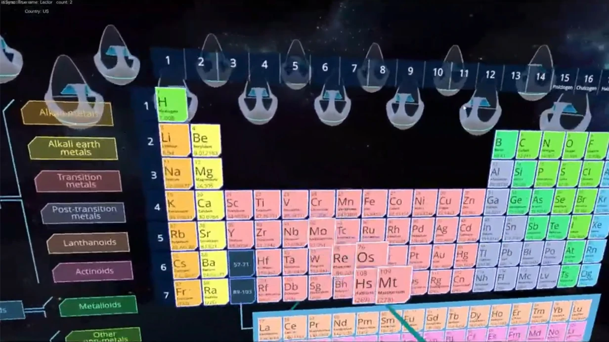
An interactive augmented reality map solves this. AR print brings the plan to life: exhibits "tell" visitors about themselves, routes light up, and visitors choose where to go next.
Bringing an exhibition to life starts with the map in the guest's hand: they linger at the stands longer, get engaged in the experience, and explore the halls with interest instead of at random.
Visitor engagement is built around the map: guests stay in the space longer, share photos and impressions, and brands get measurable contact with the audience. We help close that gap — turning maps and plans into a focal point that works toward your result.
What AR print delivers: impressions, engagement, memorability
Ordinary maps and plans convey information but quickly lose the visitor's attention. AR print turns them into an interactive exhibition: point your smartphone camera at the diagram — and it comes alive, showing routes, exhibits, and hidden details.
This is not a decorative trick but a working tool that increases time at the stand and creates an emotion that stays with people for a long time.
For a business, this translates into:
- Higher engagement: guests return to the plan several times, explore the details, and share their impressions.
- Greater recognition: the unusual format prompts photos and posts on social media — reach grows without extra ad spend.
- More time at the stand: instead of a quick glance at paper, visitors spend minutes interacting with the brand.
- Brand memorability: the emotional experience cements the association with the company and increases the likelihood of repeat contact.
| Format | Target audience | What the client gets |
|---|---|---|
| Exhibition map | Visitors and partners | Longer time at the stand, more conversations, a natural news hook |
| Museum floor plan | Exhibition guests | Simple navigation and extra content without a guide |
| Branded city map | Tourists and locals | Game-like engagement, a memorable souvenir, mentions on social media |
Launching requires no app installation: it uses AR technologies built into modern smartphones — the audience doesn't need to download anything. Our team handles layout preparation, scenario setup, and testing.
You get a ready-to-use tool that enhances the event experience and works on the key metrics: engagement, time at the stand, and brand memorability.
AR print formats for maps and plans to fit your goals
Paper maps and plans rarely hold a guest's attention for longer than a couple of seconds. The visitor looks at the diagram, can't find what they need, and goes to look for staff — extra load on the team and wasted time.
AR print turns a static sheet into an interactive plan: bring your smartphone camera closer — and the map comes to life, showing details, animation, and routes.
For a business, this is not just "digitalization for the sake of it." Guests stay longer in the space, explore objects on their own, and share impressions on social media — the brand gains reach without an additional advertising budget.
AR print formats
There is no single "right" format — everything depends on the point of contact with the visitor. In our projects, four options are used most often:
| Format | Target audience | What the client gets |
|---|---|---|
| Wall-mounted AR map | Museums, exhibition halls, business center lobbies | The visitor sees the overall layout of the exhibition, and augmented reality points out the most interesting routes and objects — fewer questions for staff |
| AR booklet and brochure | Tourist routes, catalogs, event programs | Compact print "comes alive" in the guest's hands: video, 3D models, hidden bonuses — engagement and contact time with the material increase |
| Floor AR navigation | Shopping malls, airports, large spaces, event venues | Guides visitor flow without stationary stands, looks impressive, and is easy to apply to parquet, tile, or carpet |
| Interactive floor plan on a tablet | Business centers, spa complexes, private clubs | A premium way to present information: a building plan with a tour of the premises, contacts, and visualizations of services |
How to choose a format
Start with your goal. If the task is to guide a guest through a large exhibition and reduce the load on staff, choose a wall map or floor navigation. If it matters that the visitor takes the information with them — go with an AR booklet or brochure.
Describe your task in a few words — we'll suggest the optimal format for your budget and venue. Often one project combines two options: a wall plan for a general overview and floor markers for key routes.
How the work proceeds: from brief to AR project launch
When you order AR print for maps and plans, it's important to understand how the work goes. We've structured the process so that you see the result at every stage and can influence the project. No surprises — just consecutive steps that lead to launch.
- Brief. We discuss the goals, audience, and usage scenario for the map or plan. We record what the AR print should show and what result you expect.
- Proposal. We select the format and functionality, describe how it will work, and show the timeline. You make the decision without technical details.
- Concept approval. We finalize the visual style, texts, videos, and other elements. Before production begins, you see the mockups and make edits.
- Production. We build the AR layer: anchoring to objects on the map, pop-up materials, animation. We use professional equipment and software to ensure a stable result.
- Testing. We verify performance on different devices and in different conditions. We eliminate inaccuracies so the launch goes without a hitch.
- Launch and support. We hand over the finished project, user instructions, and support you after launch. If necessary, we quickly refine the AR print.
In the end, you get working AR print that engages users and solves your business problem. The process usually takes a few weeks — we name the exact timeline after the brief. Start with a short call: we'll discuss the task and offer a solution.
What's included in the delivery: a complete kit for your project
When you order AR print for maps and plans, it's important to understand: you're getting not just an image with an effect, but a ready-made solution that will work from day one.
The kit is assembled so your staff and visitors can start using the interactive experience right away — without lengthy setup or confusion.
What's included
- Ready-made AR scenes for your maps and plans. Point a smartphone camera at a point, route, or zone — and animations, hints, and 3D objects appear before the guest, bringing the printed base to life.
- A viewer app under your brand. We publish it in the app stores and customize the icon and splash screen. The visitor doesn't need to look for anything: just point the camera at the marker on the printed material.
- Instructions for guests and staff. Short "how to launch" guides and video tips. You can place them next to the stand, at the information desk, or send them to participants.
- Training for your team. We run a short online workshop, after which your employees can explain the mechanics to guests, help with setup, and answer common questions themselves.
- Technical support throughout the event. We're on call during the opening and the run of the exhibition: we help with content updates, quickly resolve failures, and don't let the interactive experience drop out at the most important moment.
- Usage analytics. You see which zones on the plan attract more attention, how many people activated the AR, and how long they interacted with it. This data will be useful for future projects.
In the end, you're ordering not just a "living picture," but a clear package: from scenes and the app to training and support. Tell us about your maps and plans — we'll prepare a detailed proposal for your task.
Case study: how AR print brought a museum exhibition to life
Visitors come to the museum to see the exhibits, but often limit themselves to a quick walk through the halls. A static paper plan doesn't hold attention: the guest follows the arrows, stops at a couple of display cases, and leaves.
As a result, the exhibition never reveals its potential, and the museum loses the visitor's time — and the opportunity to extend the visit.
We solved this problem with AR print for maps and plans. The same paper diagrams became interactive: point your smartphone camera — and hidden details "come alive" on the plan, curator video stories appear, and 3D reconstructions of historical artifacts emerge.
The visitor chooses their own route, but now every point on the map holds their attention for several minutes.
The project results speak for themselves. Average time spent in the halls grew by about a third, the number of repeat visits noticeably increased, and guests began sharing photos and reviews on social media more often.
For the museum, this is not just "interactivity" — it's growth in attendance, depth of engagement with the collection, and brand recognition.
Our team handled the entire cycle: from marker design and plan layout to launching the solution and training the attendants.
The museum received a ready-made tool that works without constant supervision by technicians — and after a successful season, ordered an additional children's route with game tasks on the same AR print.
How to choose the right AR format for your project?
Choosing an AR print format is not a technical task — it's a question of where and how it will be used. The answer depends on three things: the venue, the audience, and the project's goal.
We'll guide you to a decision so the interactive experience works rather than remaining a pretty demonstration.
For a museum, AR on maps and plans is a way to turn a paper plan into an interactive guide. The visitor points the camera and sees a 3D model of an exhibit, hidden details, or a historical reconstruction.
What matters here is depth and the ability to explore at one's own pace — the format should work on the tablets and smartphones visitors hold in their hands.
For an event, speed and engagement come first. A guest won't figure out a complex interface; they need an instant result: a live hall diagram, a short animation announcing the next session, or an AR quest across the zones.
In this case, it's better to choose formats that activate within a couple of seconds and don't require installing apps.
The project's goal determines what should happen after the interaction: the visitor should remember the brand, reach a point, share a photo, or leave their contacts. Each goal has its own format — from mini-games and AR masks to interactive routes.
What matters is that the living print solves a specific business problem, not just acts as a "wow" button.
If you're unsure, send us your task and a sample layout. We'll assess the venue, audience, and goals, suggest the appropriate format, and show how it will work. This is non-binding — you'll get a ready recommendation for your project.
Frequently asked questions about AR print development
Before ordering AR print, clients often ask the same questions: how will it work for visitors, how long will it take, and what to do if the content becomes outdated. We've collected the key answers — so you can make a decision without extra negotiations and tests.
Everything below is about your benefit: guests don't need to install additional programs, and you don't need to deal with technical details. We take on the setup, testing, and support at every stage.
What devices will our AR version of maps and plans work on?
The system is compatible with most modern smartphones and tablets running iOS and Android. A visitor only needs to point the camera at the map — and the content appears on screen, without downloading separate apps or registering.
Before launch, we verify correct operation on different models, prepare a guide for guests, and if necessary, run a test launch at your event. You get a stable result even when visitors have a wide variety of devices.
What are the production timelines for AR print?
The standard cycle takes 5–10 business days after the layout and scenario are approved. During this period, we create the AR content, set up the anchoring to the map, and test everything on real devices.
If the event is approaching, there's an express option for 2–3 days. The exact timeline depends on the number of active points, animation complexity, and print format, so we fix it in the contract before work starts.
Can we update information after the print run?
Yes — that's the main advantage of AR over conventional print. We connect a content management system through which you can change texts, photos, videos, and links yourself at any time — without reprinting the run.
For example, on a shopping mall plan, you can update store locations or add the weekly promotion. Want to change the tour scenario? Edit the content as often as you need — on site it takes just a few minutes.
What do you guarantee, and what support is available after launch?
We fix the result in the contract: reliable operation of the AR installation, launch timelines, and the technical support procedure. After the project is delivered, we stay in touch — advising your staff and helping with content updates.
If failures occur during the event, we respond within a business day via video call or remotely. This reduces risks to zero and lets you focus on guests rather than technical issues.
How is the cost of AR development for maps and plans calculated?
The price depends on the scope: the print run of maps, the number of interactive objects, and the implementation variant — for a catalog, booklet, or large-format plan. We don't include hidden fees and provide a transparent estimate before work begins.
Each project is priced individually because events and museums have different goals. To get an accurate estimate, send us the layout and scenario descriptions — we'll prepare a commercial proposal within one business day.
Order AR installation development for your project
To launch an AR installation on your maps and plans, you don't need to understand the technology. Just describe the task — we'll prepare a personal proposal within one business day and take on the entire cycle of work: from layout to support on the day of the event.
After placing your order, you get:
- A launch-ready AR project: point the camera at the map and see animation, routes, or augmented descriptions.
- A tested scenario on real plans — with recognition verified under different lighting conditions.
- Staff training: your employees will be able to launch and support the installation themselves.
- Prompt support on the event day: our specialists are on call and, if needed, connect to the system remotely.
- A clear development roadmap: from a simple marker to multi-point AR navigation across halls, floors, or the entire site.
We've refined this approach across dozens of projects for museums and events. our team specializes in AR print, so you get a solution that works on visitors' regular smartphones — without app downloads or complex instructions.
The result: more time at the exhibit, active interaction with the material, and a memorable experience.
Contact us in any convenient way — send a request from the website or write to us in a messenger. We'll tell you how AR installation development proceeds in your case and share the cost and timeline in a personal proposal. You can order an AR project today — work starts after the brief is approved.